
Complete asset inventory, with GIS and ViDA export.
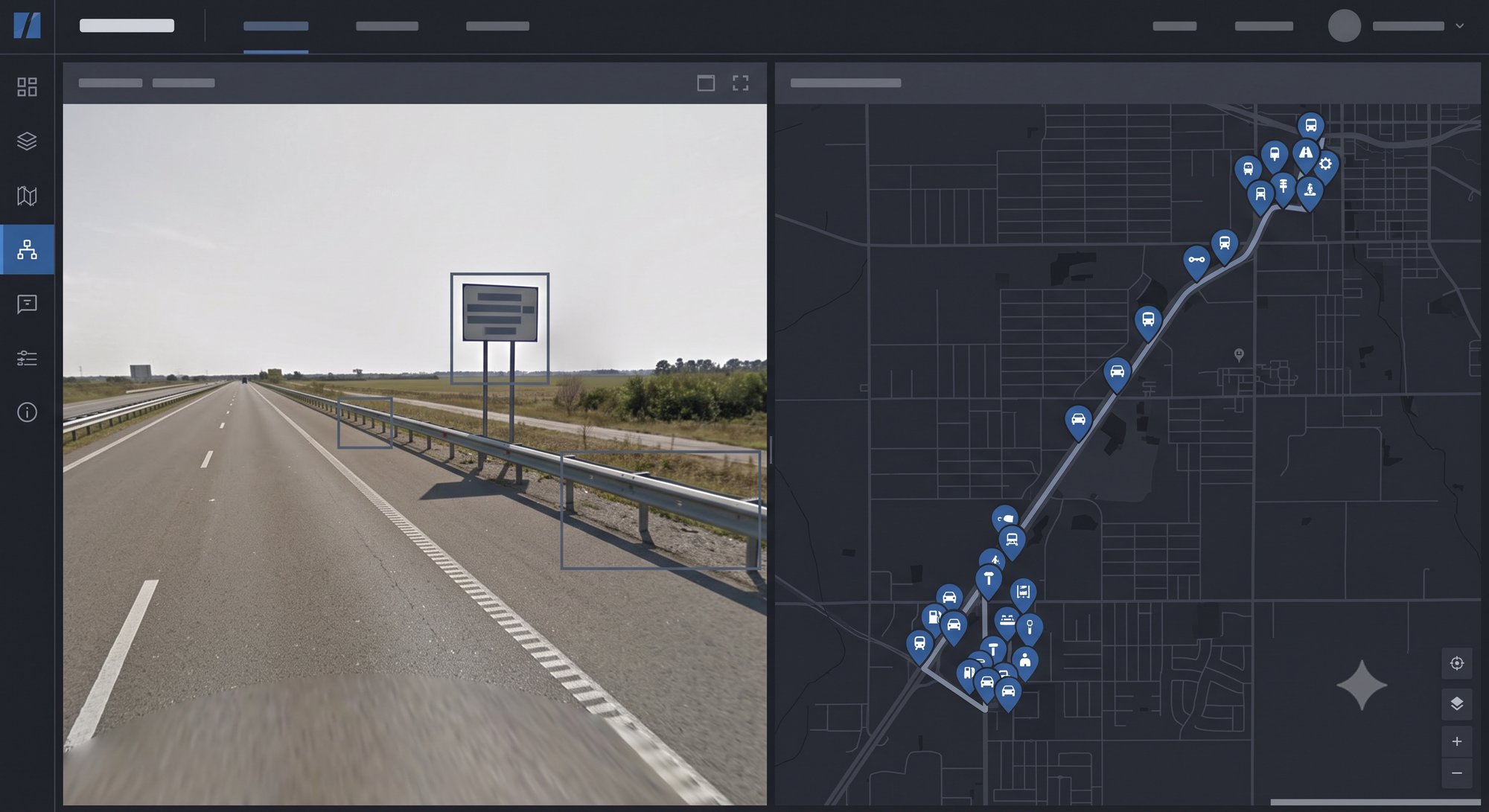
Highway asset register for asset management, contractual compliance or concession due diligence. Signage, bridges and structures, drainage, safety elements and right of way, coded on the georeferenced 360° video.
When to engage
Asset management
The concession manages high-value assets and needs a complete, up-to-date inventory.
Zero state or due diligence
On entering a concession, the baseline documents the state of the assets: the basis of the contractual obligations.
National database
Recovery programmes and the DNIT/ANTT databases require a standardised register, interoperable with GIS systems.
Sub-services — Asset Inventory
Signage
Horizontal, vertical and overhead signage, coded, georeferenced and with a photographic record.
Bridges, structures and drainage
Bridges, viaducts, footbridges, culverts and drainage devices, with a georeferenced photographic record.
Safety, protection and right of way
Barriers and guardrails, lighting and occupation of the right of way, with a georeferenced photographic record.
Data delivery (GIS/ViDA)
Export in Shapefile, KMZ, CSV and ViDA formats, interoperable with most GIS systems on the market.
Concession cycle
Zero state, baseline and monitoring of obligations throughout the contract (asset due diligence).
How we deliver
Capture or receipt of the video
Our own 360° video (from the CVS pass) or video captured by your team (BYO data).
Coding in OMNI7
Each asset is classified on the georeferenced frame, element by element.
Quality control
Full traceability. Review by element type, with a photographic record linked to the source frame.
Export and report
Final database in Shapefile, KMZ, CSV and ViDA. Report by section and by asset class.
What you receive
- Complete asset inventory, georeferenced by frame
- Export in KMZ, SHP and CSV, interoperable with GIS systems and SAP
- Export to the ViDA platform
- Georeferenced photographic record per element, linked to the source video
- Asset register tracked on the Omni platform [being rolled out]
- 78 attributes
- coded
- SHP/CSV/KMZ/ViDA
- export
- 38+ years
- of practice
Technical specifications
| Data source | Georeferenced 360° video — our own capture (CVS) or third-party (BYO) |
|---|---|
| Asset classes | Configurable according to the project and the client's requirements |
| Platform | Coding in OMNI7, with curvature and gradients calculated automatically |
| Delivery formats | Shapefile · KMZ · CSV · ViDA · docx · pdf |
| Integrations | GIS · SAP · DNIT/ANTT databases · iRAP (ViDA) |
Track and manage delivery on the OMNI7 platform
Data does not arrive only as a final package: on the OMNI7 management platform you follow the capture and the processing and then query and manage the asset inventory on a continuous basis. Discover OMNI7 →
Related projects
Digital Mapping of the State of São Paulo
Complete register of signage, bridges and structures, safety elements and remaining assets across the state network.
- 12,000 km
- registered
- SHP/CSV
- export
LOGIT and the IDB — Dar es Salaam (Tanzania)
OMNI7 platform made available for 360° digital mapping and the register of urban roads: land use, footways, cycle lanes, informal trade and parking bays.
- 100 km
- of urban roads
- 5 layers
- registered per section
EGIS Group — highways in Santa Catarina
Register of the highway elements across the Santa Catarina state network.
- 1,500 km
- of highways
- Santa Catarina
- state network
Frequently asked questions
Which assets do you register?
Horizontal, vertical and overhead signage, bridges and structures, drainage, barriers, lighting and right of way — all coded on the same 360° video from the capture.
In which formats do I receive the inventory?
Shapefile, KMZ, CSV and ViDA. The delivery is interoperable with your GIS and accepted by the iRAP process.
Does it serve due diligence and the zero state of a concession?
The asset register is used as the baseline (zero state) and in monitoring obligations throughout the concession cycle.
Does the asset register require a new field trip?
No. The register is built on the 360° video already captured — one field pass feeds the CVS, the asset register and the inspection.
How does the inventory get into my GIS?
The database is delivered in Shapefile, KMZ and CSV with standardised geometry and attributes — ready to load into your GIS or integrate with SAP.
Do you register assets on video captured by my own team?
Yes (BYO data). We apply the same coding and quality control standard to third-party 360° video.
Need a complete asset inventory?
From the zero state to the ViDA export, with monitoring on the Omni platform. Talk to a specialist.